Geolocate

Breidden Hill topographic map

Click on the map to display elevation.

About this map

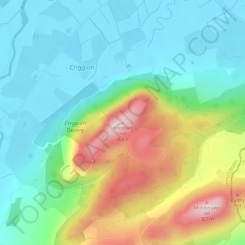
Name: Breidden Hill topographic map, elevation, terrain.

Location: Breidden Hill, Criggion, Powys, Wales, SY5 9AZ, United Kingdom (52.72269 -3.04513 52.72279 -3.04503)

Average elevation: 152 m

Minimum elevation: 58 m

Maximum elevation: 358 m

Gear up for your next adventure:

Lightweight Camping Tent - Portable shelter optimized for Canadian backcountry camping
🌡️Emergency Mylar Blankets - Compact thermal protection for unexpected nights outdoors
🛁Quick-Dry Microfiber Towel - Space-saving towel that dries rapidly on the move
🧣Merino Neck Gaiter - Protects against wind, sun, and cold at high altitudes
🥾Hiking Boots - Sturdy boots providing ankle support and traction on rugged trails

As an Amazon Associate, this site earns from qualifying purchases at no extra cost to you.