
Burs topographic map
Interactive map
Click on the map to display elevation.
About this map
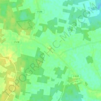
Name: Burs topographic map, elevation, terrain.
Location: Burs, Gotlands kommun, Gotlands län, Zweden (57.22510 18.48921 57.26510 18.52921)
Average elevation: 17 m
Minimum elevation: 8 m
Maximum elevation: 27 m
Other topographic maps
Click on a map to view its topography, its elevation and its terrain.
Visby
Visby, Gotlands kommun, Gotlands län, 621 45, Zweden
Average elevation: 30 m