Geolocate

Dagger Lake topographic map

Click on the map to display elevation.

About this map

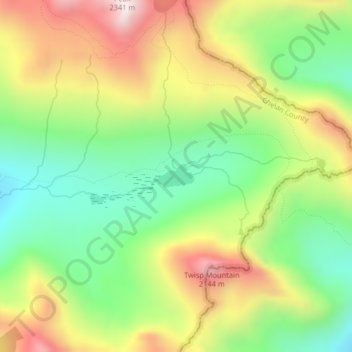
Name: Dagger Lake topographic map, elevation, terrain.

Location: Dagger Lake, Chelan County, Washington, United States (48.46737 -120.65819 48.46921 -120.65307)

Average elevation: 1,845 m

Minimum elevation: 1,554 m

Maximum elevation: 2,225 m

Other topographic maps

Click on a map to view its topography, its elevation and its terrain.

Chain Lakes

United States > Washington > Chelan County

Average elevation: 1,697 m

Cashmere

United States > Washington > Chelan County

Average elevation: 298 m

Little Bear

United States > Washington > Chelan County

Average elevation: 807 m

Jay Peak

United States > Washington > Chelan County

Average elevation: 1,829 m

Gear up for your next adventure:

👟Leg Gaiters - Keep debris, mud, and snow out of your boots
💧Hydration Pack - Hands-free hydration system for long hikes
🥫Freeze-Dried Meals - Lightweight, high-calorie nutrition for multi-day treks
🧤Insulated Winter Gloves - Heavy-duty protection for sub-zero Canadian adventures
🛏️Sleeping Bag - Warm and compact sleeping bags for outdoor camping

As an Amazon Associate, this site earns from qualifying purchases at no extra cost to you.