Geolocate

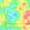
Royal Highlands topographic map

Click on the map to display elevation.

About this map

Name: Royal Highlands topographic map, elevation, terrain.

Location: Royal Highlands, Lake County, Florida, United States (28.64096 -81.88538 28.68096 -81.84538)

Average elevation: 30 m

Minimum elevation: 22 m

Maximum elevation: 46 m

Other topographic maps

Click on a map to view its topography, its elevation and its terrain.
Tavares

United States > Florida > Lake County > Tavares

Average elevation: 22 m

Jacks Lake

United States > Florida > Lake County > Clermont

Average elevation: 54 m

Mount Plymouth

United States > Florida > Lake County

Average elevation: 25 m

Erie Lake

United States > Florida > Lake County

Average elevation: 34 m

Gear up for your next adventure:

📷Outdoor Action Camera - Capture high-elevation views and rugged adventures
🥾Hiking Shorts - Breathable shorts suitable for summer hikes
👟Sport Hiking Sandals - Breathable footwear for water crossings and camp rest
🎒Hiking Daypack - Lightweight and durable backpacks for day trips and excursions
🥤Collapsible Travel Cup - Saves space and weight in your mess kit

As an Amazon Associate, this site earns from qualifying purchases at no extra cost to you.