
Lysefjorden topographic map
Interactive map
Click on the map to display elevation.
About this map
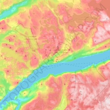
Name: Lysefjorden topographic map, elevation, terrain.
Location: Lysefjorden, Rogaland, 4128, Norvège (59.00696 6.30059 59.05160 6.64445)
Average elevation: 520 m
Minimum elevation: -1 m
Maximum elevation: 1,026 m
Other topographic maps
Click on a map to view its topography, its elevation and its terrain.
Vassfjellet
Vassfjellet, Sandbakk, Sandnes, Rogaland, 4309, Norvège
Average elevation: 124 m