
Flørli topographic map
Interactive map
Click on the map to display elevation.
About this map
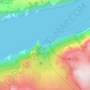
Name: Flørli topographic map, elevation, terrain.
Location: Flørli, Sandnes, Rogaland, 4128, Norvège (58.99391 6.40619 59.03391 6.44619)
Average elevation: 282 m
Minimum elevation: -8 m
Maximum elevation: 915 m
Other topographic maps
Click on a map to view its topography, its elevation and its terrain.
Vassfjellet
Vassfjellet, Sandbakk, Sandnes, Rogaland, 4309, Norvège
Average elevation: 124 m