
Ortahisar topographic map
Interactive map
Click on the map to display elevation.
About this map
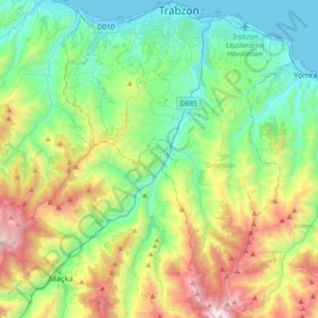
Name: Ortahisar topographic map, elevation, terrain.
Location: Ortahisar, Trabzon, Black Sea Region, Turkey (40.77444 39.61279 41.01334 39.83713)
Average elevation: 578 m
Minimum elevation: 0 m
Maximum elevation: 2,032 m
Other topographic maps
Click on a map to view its topography, its elevation and its terrain.