Geolocate

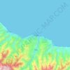
Trabzon topographic maps

Click on a map to view its topography, its elevation and its terrain.

Akçaabat

Turkey > Trabzon

Akçaabat is a municipality and district of Trabzon Province, Turkey. Its area is 375 km2, and its population is 129,290 (2022). It lies on the Black Sea coast, to the west of the city of Trabzon. Its elevation is ten metres (33 ft). Akçaabat is a coastal town known for its local soccer team Akçaabat…

Average elevation: 563 m

Çaykara

Turkey > Trabzon

Çaykara (Romeika: Kadahor, Κατωχώρι) is a municipality and district of Trabzon Province, Turkey. Its area is 574 km2, and its population is 13,070 (2022). As of 2023, the Mayor of Çaykara is Hanefi Tok (AKP). Çaykara village lies in a V-shaped valley along the Solaklı River in the Pontic Mountains,…

Average elevation: 1,788 m

Soğuksu Mahallesi

Turkey > Trabzon > Ortahisar

Average elevation: 222 m

Şalpazarı

Turkey > Trabzon

Average elevation: 1,151 m

Soğanlı

Turkey > Trabzon > Çaykara

Average elevation: 615 m

Tepeköy

Turkey > Trabzon > Yomra

Average elevation: 958 m

Özlü

Turkey > Trabzon > Arsin

Average elevation: 374 m

Araklı

Turkey > Trabzon

Average elevation: 1,202 m

Uzungöl

Turkey > Trabzon > Çaykara > Uzungöl

Average elevation: 1,405 m

Taşgeçit

Turkey > Trabzon > Araklı

Average elevation: 970 m

Ortahisar Mahallesi

Turkey > Trabzon > Ortahisar

Average elevation: 72 m

Trabzon

Turkey > Trabzon > Ortahisar

Average elevation: 241 m

About this place

 •  •  •  •

Gear up for your next adventure:

🧊Insulated Water Bottle - Keeps drinks cold in summer and prevents freezing in winter
📷Outdoor Action Camera - Capture high-elevation views and rugged adventures
🛰️Satellite Messenger - Emergency communication for areas with no cell service
🥾All-Terrain Hiking Boots - Versatile boots for varied hiking conditions
🧴Bear Spray Holster - Quick-access carry for essential Canadian wilderness safety

As an Amazon Associate, this site earns from qualifying purchases at no extra cost to you.