Geolocate

Stone City topographic map

Click on the map to display elevation.

About this map

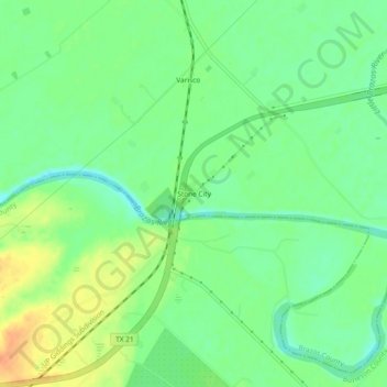
Name: Stone City topographic map, elevation, terrain.

Location: Stone City, Brazos County, Texas, United States (30.61067 -96.56204 30.65067 -96.52204)

Average elevation: 75 m

Minimum elevation: 59 m

Maximum elevation: 97 m

Other topographic maps

Click on a map to view its topography, its elevation and its terrain.

College Station

United States > Texas > Brazos County

Average elevation: 87 m

College Station

United States > Texas > Brazos County

Average elevation: 87 m

Bryan

United States > Texas > Brazos County

Average elevation: 92 m

Wixon Valley

United States > Texas > Brazos County

Average elevation: 99 m

Bryan

United States > Texas > Brazos County

Average elevation: 92 m

College Station

United States > Texas > Brazos County

Average elevation: 87 m

Bryan

United States > Texas > Brazos County

Average elevation: 92 m

Bryan

United States > Texas > Brazos County

Average elevation: 92 m

Gear up for your next adventure:

💧Hydration Bladder - Hands-free hydration solution for long treks
🧥Fleece Jacket - Warm and lightweight jacket for layering
🥾Waterproof Trail Shoes - Shoes designed to handle wet terrain
🧦Thermal Socks - Warm socks for winter hiking or camping
👖Convertible Hiking Pants - Zip-off legs to adapt to changing weather conditions

As an Amazon Associate, this site earns from qualifying purchases at no extra cost to you.