Geolocate

Denton topographic map

Click on the map to display elevation.

About this map

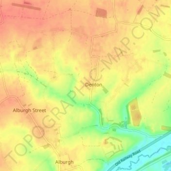
Name: Denton topographic map, elevation, terrain.

Location: Denton, South Norfolk, Norfolk, England, United Kingdom (52.42661 1.31822 52.46698 1.38248)

Average elevation: 38 m

Minimum elevation: 7 m

Maximum elevation: 55 m

Gear up for your next adventure:

🔪Outdoor Multitool - Versatile tool for repairs and food prep in the wild
🧦Crew Hiking Socks - Comfortable socks for long-distance hikes
🧰Survival Kit - Essential gear for emergencies in the wilderness
🧥Waterproof Pants - Keep dry during rainy hiking conditions
🛶Waterproof Dry Bags - Keep electronics and clothes dry during river crossings

As an Amazon Associate, this site earns from qualifying purchases at no extra cost to you.