
Make a donation
Gear up for your next adventure:
As an Amazon Associate, this site earns from qualifying purchases at no extra cost to you.
Natuurtuin Goffert topographic map
Click on the map to display elevation.
Make a donation
Gear up for your next adventure:
As an Amazon Associate, this site earns from qualifying purchases at no extra cost to you.
About this map
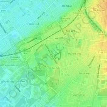
Name: Natuurtuin Goffert topographic map, elevation, terrain.
Average elevation: 21 m
Minimum elevation: 8 m
Maximum elevation: 37 m
Make a donation
Gear up for your next adventure:
As an Amazon Associate, this site earns from qualifying purchases at no extra cost to you.
Other topographic maps
Click on a map to view its topography, its elevation and its terrain.
Nijmegen
Nederland > Gelderland > Nijmegen
Op 28 augustus 1979 vond in Nijmegen ter hoogte van de Muntweg een ernstig treinongeluk plaats met 8 doden en 37 gewonden. Een lege forensentrein uit Wijchen, die door een wisselstoring abusievelijk op het linkerspoor terecht was gekomen, botste frontaal op de stoptrein naar 's-Hertogenbosch. Onder de doden…
Average elevation: 19 m
Spiegelwaal
Nederland > Gelderland > Nijmegen
De Spiegelwaal is een nevengeul van ongeveer 4 kilometer in de Waal ter hoogte van Nijmegen.
Average elevation: 12 m
Make a donation
Gear up for your next adventure:
As an Amazon Associate, this site earns from qualifying purchases at no extra cost to you.