Geolocate

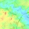
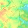
Cookley topographic map

Click on the map to display elevation.

About this map

Name: Cookley topographic map, elevation, terrain.

Location: Cookley, East Suffolk, Suffolk, England, United Kingdom (52.31653 1.42720 52.34015 1.48857)

Average elevation: 34 m

Minimum elevation: 9 m

Maximum elevation: 54 m

Other topographic maps

Click on a map to view its topography, its elevation and its terrain.
Hinton

United Kingdom > England > Suffolk > East Suffolk > Blythburgh

Average elevation: 19 m

Hulver Street

United Kingdom > England > Suffolk > East Suffolk

Average elevation: 16 m

Sibton Green

United Kingdom > England > Suffolk > East Suffolk

Average elevation: 35 m

Sweffling

United Kingdom > England > Suffolk > East Suffolk

Average elevation: 32 m

Thorpeness

United Kingdom > England > Suffolk > East Suffolk

Average elevation: 4 m

Eastbridge

United Kingdom > England > Suffolk > East Suffolk

Average elevation: 10 m

Benhall Green

United Kingdom > England > Suffolk > East Suffolk

Average elevation: 21 m

Henstead

United Kingdom > England > Suffolk > East Suffolk

Average elevation: 13 m

Somerleyton

United Kingdom > England > Suffolk > East Suffolk

Average elevation: 9 m

Butley Abbey

United Kingdom > England > Suffolk > East Suffolk > Butley

Average elevation: 9 m

Kelsale

United Kingdom > England > Suffolk > East Suffolk

Average elevation: 32 m

Wangford

United Kingdom > England > Suffolk > East Suffolk

Average elevation: 13 m

Wenhaston

United Kingdom > England > Suffolk > East Suffolk

Average elevation: 16 m

Thorpeness

United Kingdom > England > Suffolk > East Suffolk

Average elevation: 4 m

Wangford

United Kingdom > England > Suffolk > East Suffolk

Average elevation: 13 m

Sizewell

United Kingdom > England > Suffolk > East Suffolk > Leiston

Average elevation: 5 m

Sweffling

United Kingdom > England > Suffolk > East Suffolk

Average elevation: 32 m

Sizewell

United Kingdom > England > Suffolk > East Suffolk > Leiston

Average elevation: 5 m

Wangford

United Kingdom > England > Suffolk > East Suffolk

Average elevation: 13 m

Gear up for your next adventure:

🧦Hiking Socks - Moisture-wicking and comfortable socks for long hikes
💡Compact LED Flashlight - Powerful and portable flashlight for outdoor use
💧Reusable Water Bottle - Durable water bottles for hydration on trails
⛺Camping Groundsheet - Protect your tent from moisture and dirt
🥾Mountain Hiking Shoes - Shoes with superior grip for mountainous terrain

As an Amazon Associate, this site earns from qualifying purchases at no extra cost to you.