Geolocate

Gemünd topographic map

Click on the map to display elevation.

About this map
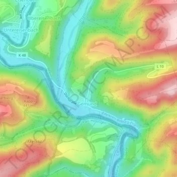
Name: Gemünd topographic map, elevation, terrain.

Location: Gemünd, Südeifel, Eifelkreis Bitburg-Prüm, Rijnland-Palts, Duitsland (49.98064 6.15381 50.00210 6.18312)

Average elevation: 340 m

Minimum elevation: 229 m

Maximum elevation: 492 m

Other topographic maps

Click on a map to view its topography, its elevation and its terrain.

Gear up for your next adventure:

🔪Outdoor Multitool - Versatile tool for repairs and food prep in the wild
⛺Bushcraft Tarp - Versatile emergency shelter or gear protection
🚲MTB Frame Bag - Carry tools and maps directly on your bicycle frame
💡LED Headlamp - Hands-free illumination for night hiking and camping
🛌Down Sleeping Bag - Superior warmth-to-weight ratio for cold nights

As an Amazon Associate, this site earns from qualifying purchases at no extra cost to you.