Geolocate

Peasmarsh topographic map

Click on the map to display elevation.

About this map

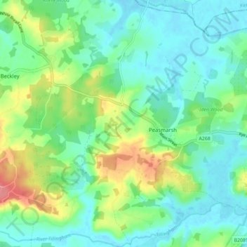
Name: Peasmarsh topographic map, elevation, terrain.

Location: Peasmarsh, Rother, East Sussex, England, United Kingdom (50.94688 0.64885 51.00154 0.71598)

Average elevation: 24 m

Minimum elevation: -2 m

Maximum elevation: 83 m

Gear up for your next adventure:

Camping Essentials - All-in-one gear for a comfortable camping trip
🥾Waterproof Hiking Boots - Essential footwear for rugged terrain and wet Canadian trails
🧦Hiking Liner Socks - Thin base layer to prevent friction and blisters
🥾Trail Hiking Shoes - Durable shoes designed for rugged trails
🛌Insulated Sleeping Pad - Critical thermal barrier between you and the cold ground

As an Amazon Associate, this site earns from qualifying purchases at no extra cost to you.