
Make a donation
Gear up for your next adventure:
As an Amazon Associate, this site earns from qualifying purchases at no extra cost to you.
De Winton topographic map
Click on the map to display elevation.
Make a donation
Gear up for your next adventure:
As an Amazon Associate, this site earns from qualifying purchases at no extra cost to you.
About this map
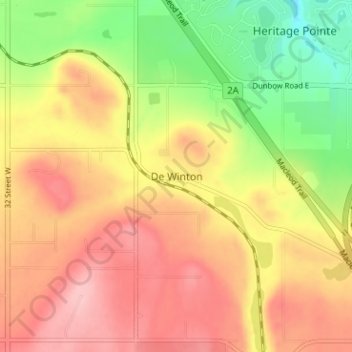
Name: De Winton topographic map, elevation, terrain.
Location: De Winton, Foothills County, Alberta, T2V 3Z4, Canada (50.80359 -114.03744 50.84359 -113.99744)
Average elevation: 1,104 m
Minimum elevation: 1,020 m
Maximum elevation: 1,172 m
Foothills County trails, hiking, mountain biking, running and outdoor activities
Make a donation
Gear up for your next adventure:
As an Amazon Associate, this site earns from qualifying purchases at no extra cost to you.
Other topographic maps
Click on a map to view its topography, its elevation and its terrain.
Make a donation
Gear up for your next adventure:
As an Amazon Associate, this site earns from qualifying purchases at no extra cost to you.