
Ingelheim am Rhein topographic map
Interactive map
Click on the map to display elevation.
About this map
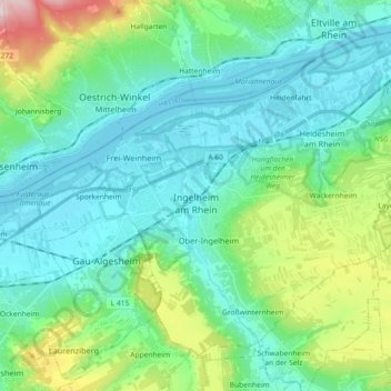
Name: Ingelheim am Rhein topographic map, elevation, terrain.
Average elevation: 157 m
Minimum elevation: 78 m
Maximum elevation: 449 m
Other topographic maps
Click on a map to view its topography, its elevation and its terrain.
Oppenheim
Germany > Rhineland-Palatinate > Landkreis Mainz-Bingen
Oppenheim, Rhein-Selz, Landkreis Mainz-Bingen, Rhineland-Palatinate, 55276, Germany
Average elevation: 121 m
Budenheim
Germany > Rhineland-Palatinate > Landkreis Mainz-Bingen
Budenheim, Landkreis Mainz-Bingen, Rhineland-Palatinate, 55257, Germany
Average elevation: 113 m
Nierstein
Germany > Rhineland-Palatinate > Landkreis Mainz-Bingen
Nierstein, Rhein-Selz, Landkreis Mainz-Bingen, Rhineland-Palatinate, 55283, Germany
Average elevation: 124 m