Geolocate

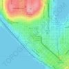
Alki Beach topographic map

Click on the map to display elevation.

About this map

Name: Alki Beach topographic map, elevation, terrain.

Location: Alki Beach, West Seattle, Seattle, King County, Washington, United States (47.57943 -122.41090 47.58407 -122.40072)

Average elevation: 32 m

Minimum elevation: 0 m

Maximum elevation: 120 m

Other topographic maps

Click on a map to view its topography, its elevation and its terrain.
Carkeek Park

United States > Washington > King County > Seattle

Average elevation: 64 m

Kerry Park

United States > Washington > King County > Seattle

Average elevation: 52 m

Kerry Park

United States > Washington > King County > Seattle

Average elevation: 52 m

Sturgus Park

United States > Washington > King County > Seattle

Average elevation: 51 m

High Point

United States > Washington > King County > Seattle

Average elevation: 88 m

Bamboo Park

United States > Washington > King County > Seattle

Average elevation: 49 m

Alki Beach

United States > Washington > King County > Seattle

Average elevation: 32 m

Woodland Park

United States > Washington > King County > Seattle

Average elevation: 71 m

Pigeon Point

United States > Washington > King County > Seattle

Average elevation: 21 m

Nantes Park

United States > Washington > King County > Seattle

Average elevation: 53 m

Gear up for your next adventure:

⛺Lightweight Camping Tent - Portable shelter optimized for Canadian backcountry camping
🧭GPS Outdoor Watch - Smart watch for navigation and fitness tracking in nature
🥾All-Terrain Hiking Boots - Versatile boots for varied hiking conditions
🚲Handlebar Phone Mount - View topographic-map.com live while cycling
🧣Merino Neck Gaiter - Protects against wind, sun, and cold at high altitudes

As an Amazon Associate, this site earns from qualifying purchases at no extra cost to you.