Geolocate

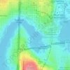
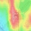
Pigeon Point topographic map

Click on the map to display elevation.

About this map

Name: Pigeon Point topographic map, elevation, terrain.

Location: Pigeon Point, Seattle, King County, Washington, 98134, United States (47.57111 -122.35930 47.57121 -122.35920)

Average elevation: 21 m

Minimum elevation: -5 m

Maximum elevation: 121 m

Other topographic maps

Click on a map to view its topography, its elevation and its terrain.
Carkeek Park

United States > Washington > King County > Seattle

Average elevation: 64 m

Kerry Park

United States > Washington > King County > Seattle

Average elevation: 52 m

Portage Bay

United States > Washington > King County > Seattle

Average elevation: 28 m

Sturgus Park

United States > Washington > King County > Seattle

Average elevation: 51 m

Bamboo Park

United States > Washington > King County > Seattle

Average elevation: 49 m

Alki Beach

United States > Washington > King County > Seattle

Average elevation: 32 m

North Beach

United States > Washington > King County > Seattle

Average elevation: 29 m

Shilshole Bay

United States > Washington > King County > Seattle

Average elevation: 17 m

Woodland Park

United States > Washington > King County > Seattle

Average elevation: 71 m

Chinatown

United States > Washington > King County > Seattle

Average elevation: 41 m

Little Saigon

United States > Washington > King County > Seattle

Average elevation: 54 m

Nantes Park

United States > Washington > King County > Seattle

Average elevation: 53 m

Gear up for your next adventure:

🧢Sun Hat - Wide-brim hat for sun protection
🥘Camping Cookware Set - Compact nesting pots and pans for trail cooking
🥾Trail Hiking Boots - Supportive boots for rough trails
🔋Solar Power Bank - Keep your GPS and devices charged during long outdoor trips
☕Camping Coffee Maker - Brew fresh coffee anywhere on the topographic map

As an Amazon Associate, this site earns from qualifying purchases at no extra cost to you.