Geolocate

Penshurst topographic map

Click on the map to display elevation.

About this map
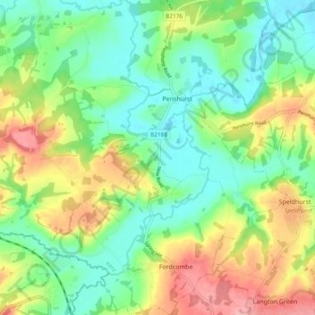
Name: Penshurst topographic map, elevation, terrain.

Location: Penshurst, Sevenoaks, Kent, England, United Kingdom (51.13180 0.15014 51.19077 0.21539)

Average elevation: 66 m

Minimum elevation: 24 m

Maximum elevation: 135 m

Gear up for your next adventure:

👟Leg Gaiters - Keep debris, mud, and snow out of your boots
🥾Mountaineering Boots - Supportive boots for climbing and high-altitude hiking
🥾Waterproof Hiking Boots - Boots keeping your feet dry in wet conditions
🌬️Windproof Camp Stove - Efficient cooking even on exposed mountain peaks
🕶️Polarized Sunglasses - Protect your eyes with durable polarized lenses

As an Amazon Associate, this site earns from qualifying purchases at no extra cost to you.