
Sequoyah County topographic map
Click on the map to display elevation.
About this map
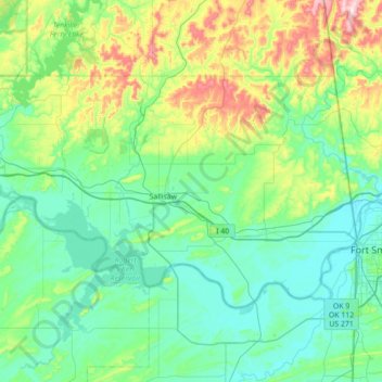
Name: Sequoyah County topographic map, elevation, terrain.
Location: Sequoyah County, Oklahoma, United States (35.29042 -95.13233 35.63872 -94.43121)
Average elevation: 211 m
Minimum elevation: 120 m
Maximum elevation: 585 m
Other topographic maps
Click on a map to view its topography, its elevation and its terrain.
Southwest Oklahoma City Sludge Lagoon Dam
United States > Oklahoma > Cleveland County > Oklahoma City
Average elevation: 348 m
Lake Thunderbird Dam
United States > Oklahoma > Cleveland County > Norman > Little Axe
Average elevation: 318 m