Geolocate

Ardmore topographic map

Click on the map to display elevation.

About this map

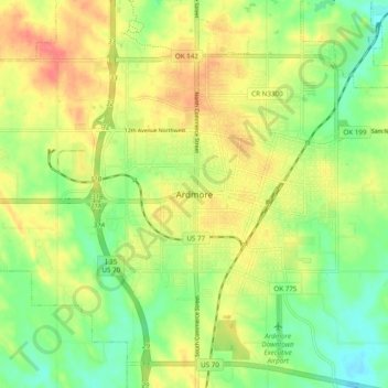
Name: Ardmore topographic map, elevation, terrain.

Location: Ardmore, Carter County, Oklahoma, 73401, United States (34.13426 -97.18363 34.21426 -97.10363)

Average elevation: 262 m

Minimum elevation: 232 m

Maximum elevation: 295 m

Gear up for your next adventure:

🪜Heavy Duty Carabiners - Multi-use clips for securing gear to your backpack
🧰Multitool Knife - Compact and versatile tool for outdoor use
🧤Insulated Winter Gloves - Heavy-duty protection for sub-zero Canadian adventures
🧦Hiking Liner Socks - Thin base layer to prevent friction and blisters
🔥Camping Stove - Portable stoves to cook outdoors with ease

As an Amazon Associate, this site earns from qualifying purchases at no extra cost to you.