Geolocate

Tossene topographic map

Click on the map to display elevation.

About this map

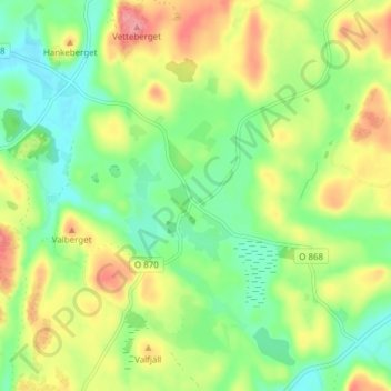
Name: Tossene topographic map, elevation, terrain.

Location: Tossene, Sotenäs kommun, Västra Götaland County, Sweden (58.42695 11.35812 58.46695 11.39812)

Average elevation: 53 m

Minimum elevation: 14 m

Maximum elevation: 109 m

Other topographic maps

Click on a map to view its topography, its elevation and its terrain.

Gear up for your next adventure:

🥾Hiking Gaiters - Protect legs and shoes from mud, snow, and debris
🛏️Sleeping Bag - Warm and compact sleeping bags for outdoor camping
🎒Hiking Backpack - Lightweight and ergonomic backpacks for day hikes or multi-day treks
🥾Trail Hiking Boots - Supportive boots for rough trails
🥾Trail Hiking Shoes - Durable shoes designed for rugged trails

As an Amazon Associate, this site earns from qualifying purchases at no extra cost to you.