Geolocate

Kinderdijk topographic map

Click on the map to display elevation.

👉 Easily get elevation data in JSON, GeoTIFF and KML formats using Elevation API
Thank you for supporting this site ❤️
Make a donation

About this map

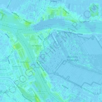
Name: Kinderdijk topographic map, elevation, terrain.

Location: Kinderdijk, Molenlanden, South Holland, Netherlands (51.87495 4.61925 51.89091 4.66856)

Average elevation: 1 m

Minimum elevation: -4 m

Maximum elevation: 12 m

Other topographic maps

Click on a map to view its topography, its elevation and its terrain.

Botlek

Netherlands > South Holland

Average elevation: 3 m

Meije

Netherlands > South Holland > Nieuwkoop

Average elevation: -2 m

Langeraar

Netherlands > South Holland

Average elevation: -3 m

Weerestein

Netherlands > South Holland > Hillegom

Average elevation: 0 m

Broekhuizen

Netherlands > South Holland > Gouda

Average elevation: -1 m

Ankerpark

Netherlands > South Holland > Leiden

Average elevation: 3 m

Middelsluis

Netherlands > South Holland > Numansdorp

Average elevation: 0 m

Weerestein

Netherlands > South Holland > Hillegom

Average elevation: 0 m

Meijendel

Netherlands > South Holland > Wassenaar

Average elevation: 6 m

Coepelduynen

Netherlands > South Holland > Katwijk

Average elevation: 4 m

Het Park

Netherlands > South Holland > Rotterdam

Average elevation: 4 m

Waalhaven

Netherlands > South Holland > Rotterdam

Average elevation: 3 m

Gear up for your next adventure:

🧳Compression Sacks - Maximize space in your backpack by shrinking gear
🧴Bear Spray Holster - Quick-access carry for essential Canadian wilderness safety
🗺️Topographic Maps - Detailed maps to explore trails, mountains, and wilderness areas
Lightweight Camping Tent - Portable shelter optimized for Canadian backcountry camping
🍽️Titanium Camping Spork - Ultralight and indestructible eating utensil

As an Amazon Associate, this site earns from qualifying purchases at no extra cost to you.