Geolocate

Meije topographic map

Click on the map to display elevation.

About this map

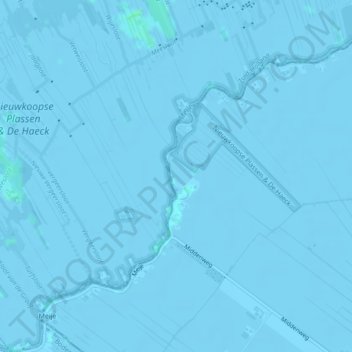
Name: Meije topographic map, elevation, terrain.

Location: Meije, Nieuwkoop, South Holland, Netherlands (52.12255 4.79199 52.14438 4.83188)

Average elevation: -2 m

Minimum elevation: -4 m

Maximum elevation: 4 m

Other topographic maps

Click on a map to view its topography, its elevation and its terrain.

Nieuwkoop

Netherlands > South Holland > Nieuwkoop

Average elevation: -3 m

Gear up for your next adventure:

🕶️Polarized Sunglasses - Protect your eyes with durable polarized lenses
🧣Merino Neck Gaiter - Protects against wind, sun, and cold at high altitudes
Lightweight Backpacking Tent - Compact tent for efficient hiking trips
🪑Insulated Seat Pad - Protect your seat from cold rocks and wet logs
🎒Hiking Backpack - Lightweight and ergonomic backpacks for day hikes or multi-day treks

As an Amazon Associate, this site earns from qualifying purchases at no extra cost to you.