Geolocate

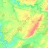
Nizerolle topographic map

Click on the map to display elevation.

About this map

Name: Nizerolle topographic map, elevation, terrain.

Location: Nizerolle, Bussy, Saint-Amand-Montrond, Cher, Centre-Val de Loire, France métropolitaine, 18130, France (46.88896 2.58026 46.92896 2.62026)

Average elevation: 179 m

Minimum elevation: 166 m

Maximum elevation: 191 m

Other topographic maps

Click on a map to view its topography, its elevation and its terrain.
Bussy

France > Centre-Val de Loire > Cher > Bussy

Average elevation: 178 m

Gear up for your next adventure:

🕯️Camping Lantern - Illuminates your entire campsite with high-efficiency LEDs
⛺Tent Footprint - Protect tent floor and increase durability
🛏️Camping Sleeping Mat - Comfortable mats for sleeping outdoors
🥾Approach Shoes - Shoes designed for climbing approaches and rugged trails
🔥Emergency Fire Starter - Reliable ignition source for all weather conditions

As an Amazon Associate, this site earns from qualifying purchases at no extra cost to you.