Geolocate

Bussy topographic map

Click on the map to display elevation.

About this map
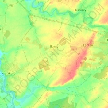
Name: Bussy topographic map, elevation, terrain.

Location: Bussy, Saint-Amand-Montrond, Cher, Centre-Val de Loire, France métropolitaine, 18130, France (46.85838 2.58540 46.94221 2.65916)

Average elevation: 178 m

Minimum elevation: 157 m

Maximum elevation: 201 m

Other topographic maps

Click on a map to view its topography, its elevation and its terrain.

Nizerolle

France > Centre-Val de Loire > Cher > Bussy

Average elevation: 179 m

Gear up for your next adventure:

🧢Outdoor Cap - Protective cap for sun and rain during hikes
⛺Family Camping Tent - Spacious tent suitable for family camping trips
🥾Trekking Poles - Adjustable trekking poles to reduce knee stress and improve stability
🕯️Camping Lantern - Illuminates your entire campsite with high-efficiency LEDs
💡Compact LED Flashlight - Powerful and portable flashlight for outdoor use

As an Amazon Associate, this site earns from qualifying purchases at no extra cost to you.