Geolocate

Lowton topographic map

Click on the map to display elevation.

About this map

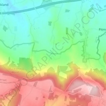
Name: Lowton topographic map, elevation, terrain.

Location: Lowton, Pitminster, Somerset, England, TA3 7SX, United Kingdom (50.93870 -3.16362 50.97870 -3.12362)

Average elevation: 145 m

Minimum elevation: 48 m

Maximum elevation: 296 m

Gear up for your next adventure:

🚲MTB Frame Bag - Carry tools and maps directly on your bicycle frame
👖Convertible Hiking Pants - Zip-off legs to adapt to changing weather conditions
🔋Lithium AA Batteries - Long-lasting power that performs in extreme cold
👟Leg Gaiters - Keep debris, mud, and snow out of your boots
🥾Hiking Shorts - Breathable shorts suitable for summer hikes

As an Amazon Associate, this site earns from qualifying purchases at no extra cost to you.