Geolocate

Mud Bay topographic map

Click on the map to display elevation.

About this map

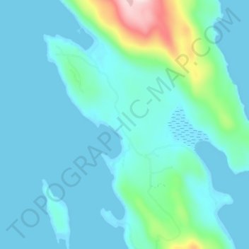
Name: Mud Bay topographic map, elevation, terrain.

Location: Mud Bay, Haines, Alaska, United States (59.13972 -135.39583 59.17972 -135.35583)

Average elevation: 48 m

Minimum elevation: -4 m

Maximum elevation: 352 m

Other topographic maps

Click on a map to view its topography, its elevation and its terrain.

Lutak

United States > Alaska > Haines

Average elevation: 654 m

Gear up for your next adventure:

🔭Compact Binoculars - Lightweight optics for scouting trails and wildlife
Family Camping Tent - Spacious tent suitable for family camping trips
🥾Hiking Boots - Sturdy boots providing ankle support and traction on rugged trails
Lightweight Camping Tent - Portable shelter optimized for Canadian backcountry camping
Bushcraft Tarp - Versatile emergency shelter or gear protection

As an Amazon Associate, this site earns from qualifying purchases at no extra cost to you.