Geolocate

Lutak topographic map

Click on the map to display elevation.

About this map

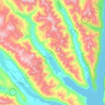
Name: Lutak topographic map, elevation, terrain.

Location: Lutak, Haines, Alaska, United States (59.25833 -135.85550 59.50692 -135.43141)

Average elevation: 654 m

Minimum elevation: -3 m

Maximum elevation: 1,873 m

Other topographic maps

Click on a map to view its topography, its elevation and its terrain.

Covenant Life

United States > Alaska > Haines

Average elevation: 117 m

Excursion Inlet

United States > Alaska > Haines

Average elevation: 148 m

Mosquito Lake

United States > Alaska > Haines

Average elevation: 375 m

Mud Bay

United States > Alaska > Haines

Average elevation: 48 m

Cathedral Peak

United States > Alaska > Haines

Average elevation: 946 m

Gear up for your next adventure:

🥾Hiking Shoes - Durable and comfortable shoes for trail hiking
🚲Handlebar Phone Mount - View topographic-map.com live while cycling
🧣Merino Neck Gaiter - Protects against wind, sun, and cold at high altitudes
🧼Travel Hand Sanitizer - Keep hands clean when water is scarce
🔨Vehicle Emergency Tool - Safety tool for remote road trips to trailheads

As an Amazon Associate, this site earns from qualifying purchases at no extra cost to you.