Geolocate

Pore topographic map

Click on the map to display elevation.

About this map

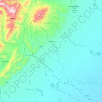
Name: Pore topographic map, elevation, terrain.

Location: Pore, Casanare, RAP Llanos, 852050, Colombia (5.52993 -72.11178 5.83975 -71.65932)

Average elevation: 351 m

Minimum elevation: 174 m

Maximum elevation: 1,497 m

Other topographic maps

Click on a map to view its topography, its elevation and its terrain.

Angelia

Colombia > Casanare > Yopal

Average elevation: 211 m

Gear up for your next adventure:

🔦LED Flashlight - Powerful and long-lasting flashlight for camping and emergencies
🔭Compact Binoculars - Lightweight optics for scouting trails and wildlife
🧥Insulated Jacket - Keep warm in cold outdoor conditions
🗺️Topographic Maps - Detailed maps to explore trails, mountains, and wilderness areas
💡Portable Camping Lamp - Rechargeable lamp for campsite lighting

As an Amazon Associate, this site earns from qualifying purchases at no extra cost to you.