Geolocate

Xin'an County topographic map

Click on the map to display elevation.

About this map

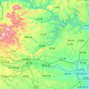
Name: Xin'an County topographic map, elevation, terrain.

Location: Xin'an County, Luoyang, Henan, China (34.60242 111.87355 35.07148 112.31925)

Average elevation: 423 m

Minimum elevation: 130 m

Maximum elevation: 1,358 m

Other topographic maps

Click on a map to view its topography, its elevation and its terrain.

Beicun

China > Henan > Luoyang

Average elevation: 469 m

Gear up for your next adventure:

🧴Sunscreen SPF - Broad-spectrum sunscreen for outdoor activities
🧭GPS Handheld Device - Reliable GPS navigation for outdoor adventures
🥾Waterproof Hiking Shoes - Durable shoes for wet and rugged trails
🧴Bear Spray Holster - Quick-access carry for essential Canadian wilderness safety
🛶Kayak Dry Bag - Waterproof storage for kayaking adventures

As an Amazon Associate, this site earns from qualifying purchases at no extra cost to you.