Geolocate

Little Wenlock topographic map

Click on the map to display elevation.

About this map

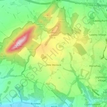
Name: Little Wenlock topographic map, elevation, terrain.

Location: Little Wenlock, Telford and Wrekin, England, United Kingdom (52.63839 -2.55937 52.69103 -2.49031)

Average elevation: 169 m

Minimum elevation: 40 m

Maximum elevation: 402 m

Other topographic maps

Click on a map to view its topography, its elevation and its terrain.

Telford

United Kingdom > England > Telford and Wrekin

Average elevation: 136 m

Dawley

United Kingdom > England > Telford and Wrekin

Average elevation: 142 m

Telford

United Kingdom > England > Telford and Wrekin

Average elevation: 136 m

Ironbridge

United Kingdom > England > Telford and Wrekin

Average elevation: 126 m

Telford

United Kingdom > England > Telford and Wrekin

Average elevation: 136 m

Ironbridge

United Kingdom > England > Telford and Wrekin

Average elevation: 126 m

Telford

United Kingdom > England > Telford and Wrekin

Average elevation: 136 m

Telford

United Kingdom > England > Telford and Wrekin

Average elevation: 136 m

Allscott

United Kingdom > England > Telford and Wrekin

Average elevation: 70 m

Jackfield

United Kingdom > England > Telford and Wrekin

Average elevation: 119 m

Play Park

United Kingdom > England > Telford and Wrekin > Dawley

Average elevation: 176 m

Dawley

United Kingdom > England > Telford and Wrekin

Average elevation: 142 m

Telford

United Kingdom > England > Telford and Wrekin

Average elevation: 136 m

Gear up for your next adventure:

🧰Emergency Multi-Tool - Compact multi-tool for outdoor survival
🥫Freeze-Dried Meals - Lightweight, high-calorie nutrition for multi-day treks
🌡️Emergency Mylar Blankets - Compact thermal protection for unexpected nights outdoors
🎒Hiking Daypack - Lightweight and durable backpacks for day trips and excursions
🧤Rechargeable Heated Gloves - Extreme warmth for Canadian winter expeditions

As an Amazon Associate, this site earns from qualifying purchases at no extra cost to you.