Geolocate

Kumbichl topographic map

Click on the map to display elevation.

About this map

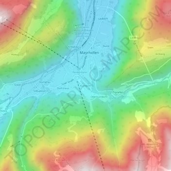
Name: Kumbichl topographic map, elevation, terrain.

Location: Kumbichl, Mayrhofen, Bezirk Schwaz, Tyrol, 6290, Austria (47.13946 11.84261 47.17946 11.88261)

Average elevation: 1,046 m

Minimum elevation: 606 m

Maximum elevation: 1,794 m

Gear up for your next adventure:

🧢Beanie Hat - Keep your head warm in cold weather
Bushcraft Tarp - Versatile emergency shelter or gear protection
🍽️Titanium Camping Spork - Ultralight and indestructible eating utensil
🔨Vehicle Emergency Tool - Safety tool for remote road trips to trailheads
🧭GPS Handheld Device - Reliable GPS navigation for outdoor adventures

As an Amazon Associate, this site earns from qualifying purchases at no extra cost to you.