
Amandi topographic map
Click on the map to display elevation.
About this map
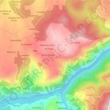
Name: Amandi topographic map, elevation, terrain.
Location: Amandi, Sober, Tierra de Lemos, Lugo, Galicia, España (42.38421 -7.52737 42.41426 -7.48122)
Average elevation: 471 m
Minimum elevation: 202 m
Maximum elevation: 674 m
Other topographic maps
Click on a map to view its topography, its elevation and its terrain.