Geolocate

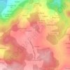
Bolmente topographic map

Click on the map to display elevation.

About this map

Name: Bolmente topographic map, elevation, terrain.

Location: Bolmente, Sober, Tierra de Lemos, Lugo, Galicia, 27425, España (42.40277 -7.60989 42.44277 -7.56989)

Average elevation: 502 m

Minimum elevation: 205 m

Maximum elevation: 680 m

Other topographic maps

Click on a map to view its topography, its elevation and its terrain.

Amandi

España > Galicia > Tierra de Lemos > Sober

Average elevation: 471 m

Gundivós

España > Galicia > Tierra de Lemos > Sober

Average elevation: 437 m

Anllo

España > Galicia > Tierra de Lemos > Sober

Average elevation: 390 m

Proendos

España > Galicia > Tierra de Lemos > Sober

Average elevation: 436 m

Lobios

España > Galicia > Tierra de Lemos > Sober

Average elevation: 522 m

Gear up for your next adventure:

💡LED Camping Lantern - Illuminate your campsite with long-lasting lanterns
⛺Family Camping Tent - Spacious tent suitable for family camping trips
🛏️Camping Sleeping Mat - Comfortable mats for sleeping outdoors
🧢Outdoor Cap - Protective cap for sun and rain during hikes
🎒Hiking Daypack - Lightweight and durable backpacks for day trips and excursions

As an Amazon Associate, this site earns from qualifying purchases at no extra cost to you.