
Thank you for supporting this site ❤️
Make a donation
Make a donation
Gear up for your next adventure:
As an Amazon Associate, this site earns from qualifying purchases at no extra cost to you.
Belasica topographic map
Click on the map to display elevation.
Thank you for supporting this site ❤️
Make a donation
Make a donation
Gear up for your next adventure:
As an Amazon Associate, this site earns from qualifying purchases at no extra cost to you.
About this map
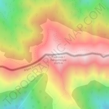
Name: Belasica topographic map, elevation, terrain.
Location: Belasica, Petrich, Blagoevgrad, 2880, Bulgaria (41.32041 23.11941 41.32051 23.11951)
Average elevation: 1,582 m
Minimum elevation: 1,026 m
Maximum elevation: 2,025 m
Thank you for supporting this site ❤️
Make a donation
Make a donation
Gear up for your next adventure:
As an Amazon Associate, this site earns from qualifying purchases at no extra cost to you.