
Clawson topographic map
Click on the map to display elevation.
About this map
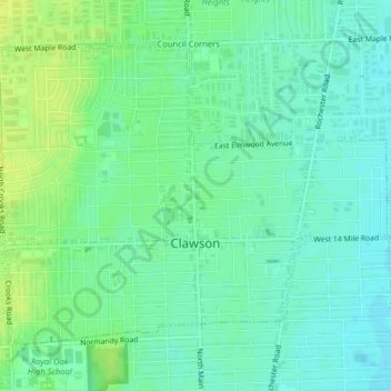
Name: Clawson topographic map, elevation, terrain.
Location: Clawson, Oakland County, Michigan, 48017, United States (42.52557 -83.16656 42.54830 -83.12673)
Average elevation: 206 m
Minimum elevation: 198 m
Maximum elevation: 215 m
Other topographic maps
Click on a map to view its topography, its elevation and its terrain.
Veterans Park
United States > Michigan > Oakland County > Highland Charter Township
Average elevation: 310 m
Waterbury Lake
United States > Michigan > Oakland County > Highland Charter Township
Average elevation: 308 m
Davisburg
United States > Michigan > Oakland County > Springfield Charter Township
Average elevation: 309 m
Round Lake
United States > Michigan > Oakland County > Orion Charter Township
Average elevation: 303 m
Hickory Ridge
United States > Michigan > Oakland County > Highland Charter Township
Average elevation: 326 m
Seven Harbors
United States > Michigan > Oakland County > Highland Charter Township
Average elevation: 314 m
Carpenter Lake Nature Preserve
United States > Michigan > Oakland County > Southfield
Average elevation: 207 m
Wood Creek Farms
United States > Michigan > Oakland County > Farmington Hills > Wood Creek Farms
Average elevation: 245 m