Geolocate

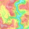
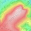
Penperlleni topographic map

Click on the map to display elevation.

About this map

Name: Penperlleni topographic map, elevation, terrain.

Location: Penperlleni, Monmouthshire, Wales, NP4 0BH, United Kingdom (51.71863 -3.00125 51.75863 -2.96125)

Average elevation: 99 m

Minimum elevation: 24 m

Maximum elevation: 316 m

Other topographic maps

Click on a map to view its topography, its elevation and its terrain.
Llanbadoc

United Kingdom > Wales > Monmouthshire

Average elevation: 78 m

Wye Valley

United Kingdom > Wales > Monmouthshire

Average elevation: 167 m

Penallt

United Kingdom > Wales > Monmouthshire

Average elevation: 174 m

Crucorney

United Kingdom > Wales > Monmouthshire

Average elevation: 297 m

Blorenge

United Kingdom > Wales > Monmouthshire > Govilon

Average elevation: 394 m

River Monnow

United Kingdom > Wales > Monmouthshire

Average elevation: 172 m

River Monnow

United Kingdom > Wales > Monmouthshire

Average elevation: 172 m

Raglan Castle

United Kingdom > Wales > Monmouthshire > Raglan

Average elevation: 59 m

Gear up for your next adventure:

👟Sport Hiking Sandals - Breathable footwear for water crossings and camp rest
🧦Thermal Socks - Warm socks for winter hiking or camping
🥾Approach Boots - Comfortable boots for hiking and climbing approaches
🪑Insulated Seat Pad - Protect your seat from cold rocks and wet logs
💡Portable Camping Lamp - Rechargeable lamp for campsite lighting

As an Amazon Associate, this site earns from qualifying purchases at no extra cost to you.