Geolocate

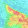
Bagneux topographic map

Click on the map to display elevation.

About this map

Name: Bagneux topographic map, elevation, terrain.

Location: Bagneux, Saumur, Maine-et-Loire, Pays de la Loire, France métropolitaine, 49400, France (47.22820 -0.11202 47.25329 -0.08375)

Average elevation: 51 m

Minimum elevation: 22 m

Maximum elevation: 81 m

Other topographic maps

Click on a map to view its topography, its elevation and its terrain.

Les Pentes

France > Pays de la Loire > Maine-et-Loire > Saumur

Average elevation: 49 m

Terrefort

France > Pays de la Loire > Maine-et-Loire > Saumur

Average elevation: 59 m

Gear up for your next adventure:

🥾Approach Boots - Comfortable boots for hiking and climbing approaches
🧰Multitool Knife - Compact and versatile tool for outdoor use
🧦Crew Hiking Socks - Comfortable socks for long-distance hikes
🥾Lightweight Hiking Shoes - Comfortable shoes for day hikes
🧥Thermal Fleece Jacket - Versatile insulation for changing mountain temperatures

As an Amazon Associate, this site earns from qualifying purchases at no extra cost to you.