Geolocate

Le Gaillardin topographic map

Click on the map to display elevation.

About this map
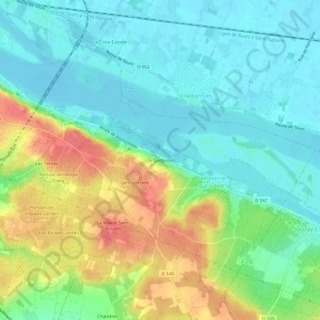
Name: Le Gaillardin topographic map, elevation, terrain.

Location: Le Gaillardin, Dampierre-sur-Loire, Saumur, Maine-et-Loire, Pays de la Loire, France métropolitaine, 49400, France (47.22487 -0.05691 47.26487 -0.01691)

Average elevation: 49 m

Minimum elevation: 24 m

Maximum elevation: 97 m

Other topographic maps

Click on a map to view its topography, its elevation and its terrain.

Saumur

France > Pays de la Loire > Maine-et-Loire > Saumur

Average elevation: 41 m

Bagneux

France > Pays de la Loire > Maine-et-Loire > Saumur

Average elevation: 51 m

Gear up for your next adventure:

💧Hydration Pack - Hands-free hydration system for long hikes
🧢Sun Hat - Wide-brim hat for sun protection
🥾Mountaineering Boots - Supportive boots for climbing and high-altitude hiking
🔋Emergency Crank Radio - Weather alerts and power without needing batteries
🛏️Sleeping Bag - Warm and compact sleeping bags for outdoor camping

As an Amazon Associate, this site earns from qualifying purchases at no extra cost to you.