Geolocate

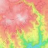
Orcières topographic map

Click on the map to display elevation.

About this map

Name: Orcières topographic map, elevation, terrain.

Location: Orcières, Neuvéglise, Neuvéglise-sur-Truyère, Saint-Flour, Cantal, Auvergne-Rhône-Alpes, France métropolitaine, 15260, France (44.89386 2.94701 44.93386 2.98701)

Average elevation: 892 m

Minimum elevation: 639 m

Maximum elevation: 1,014 m

Other topographic maps

Click on a map to view its topography, its elevation and its terrain.
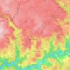
Oradour

France > Auvergne-Rhône-Alpes > Cantal > Neuvéglise-sur-Truyère

La commune d’Oradour s’étend sur 3 377 ha à une altitude moyenne de 940 m.

Average elevation: 971 m

Gear up for your next adventure:

🚑Survival Whistle - Signal for help across long distances in mountains
⛺Bushcraft Tarp - Versatile emergency shelter or gear protection
🥤Collapsible Travel Cup - Saves space and weight in your mess kit
🌬️Windproof Camp Stove - Efficient cooking even on exposed mountain peaks
🧶550 Survival Paracord - Versatile utility cord for emergency repairs and rigging

As an Amazon Associate, this site earns from qualifying purchases at no extra cost to you.