Geolocate

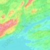
Murray topographic map

Click on the map to display elevation.

About this map

Name: Murray topographic map, elevation, terrain.

Location: Murray, Quinte West, Central Ontario, Ontario, Canada (43.99286 -77.75319 44.26391 -77.56946)

Average elevation: 124 m

Minimum elevation: 70 m

Maximum elevation: 262 m

Ontario trails, hiking, mountain biking, running and outdoor activities

Other topographic maps

Click on a map to view its topography, its elevation and its terrain.
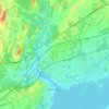
Trenton

Canada > Ontario > Quinte West

Average elevation: 89 m

Quinte West

Canada > Ontario > Quinte West

Average elevation: 110 m

Batawa

Canada > Ontario > Quinte West

Average elevation: 115 m

Wooler

Canada > Ontario > Quinte West

Average elevation: 145 m

Wooler

Canada > Ontario > Quinte West

Average elevation: 145 m

Wooler

Canada > Ontario > Quinte West

Average elevation: 145 m

Batawa

Canada > Ontario > Quinte West

Average elevation: 115 m

Gear up for your next adventure:

🧥Waterproof Jacket - Lightweight rain jackets for hiking and outdoor activities
⛺Camping Tent - Weather-resistant tents suitable for 2 to 6 people
🦟Insect Repellent - Keep mosquitoes and black flies away in wooded areas
🔭Outdoor Binoculars - Lightweight binoculars for birdwatching and hiking
🧴First Aid Kit - Essential first aid supplies for outdoor emergencies

As an Amazon Associate, this site earns from qualifying purchases at no extra cost to you.