Geolocate

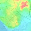
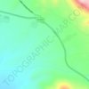
Dos Hermanas topographic map

Click on the map to display elevation.

About this map

Name: Dos Hermanas topographic map, elevation, terrain.

Location: Dos Hermanas, Sevilla, Andalusia, Spain (37.15009 -6.06202 37.36208 -5.88324)

Average elevation: 33 m

Minimum elevation: 0 m

Maximum elevation: 129 m

Other topographic maps

Click on a map to view its topography, its elevation and its terrain.
Las Navas

Spain > Andalusia > Priego de Córdoba

Average elevation: 926 m

Córdoba

Spain > Andalusia > Córdoba

Average elevation: 262 m

Las Catorce

Spain > Andalusia > Sierra de Cádiz > El Bosque

Average elevation: 364 m

Puente Nuevo

Spain > Andalusia > Alcaudete

Average elevation: 642 m

Crispín

Spain > Andalusia > Aznalcóllar

Average elevation: 66 m

Gear up for your next adventure:

💧Filtered Water Bottle - Safe drinking water on the go
🗺️Topographic Maps - Detailed maps to explore trails, mountains, and wilderness areas
🧶550 Survival Paracord - Versatile utility cord for emergency repairs and rigging
🧥Thermal Layer - Insulating layer for cold outdoor conditions
🧦Merino Wool Socks - Moisture-wicking comfort for long-distance hiking

As an Amazon Associate, this site earns from qualifying purchases at no extra cost to you.