
Casarabonela topographic map
Interactive map
Click on the map to display elevation.
About this map
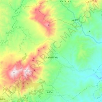
Name: Casarabonela topographic map, elevation, terrain.
Average elevation: 559 m
Minimum elevation: 106 m
Maximum elevation: 1,508 m
Other topographic maps
Click on a map to view its topography, its elevation and its terrain.
Istán
Испания > Андалусия > Sierra de las Nieves
Istán, Sierra de las Nieves, Málaga, Андалусия, 29611, Испания
Average elevation: 604 m