
Istán topographic map
Interactive map
Click on the map to display elevation.
About this map
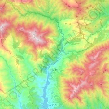
Name: Istán topographic map, elevation, terrain.
Location: Istán, Sierra de las Nieves, Málaga, Андалусия, 29611, Испания (36.53707 -5.04363 36.66049 -4.89301)
Average elevation: 604 m
Minimum elevation: 85 m
Maximum elevation: 1,327 m
Other topographic maps
Click on a map to view its topography, its elevation and its terrain.
Casarabonela
Испания > Андалусия > Sierra de las Nieves
Casarabonela, Sierra de las Nieves, Málaga, Андалусия, 29566, Испания
Average elevation: 559 m