Geolocate

Kenstone topographic map

Click on the map to display elevation.

About this map

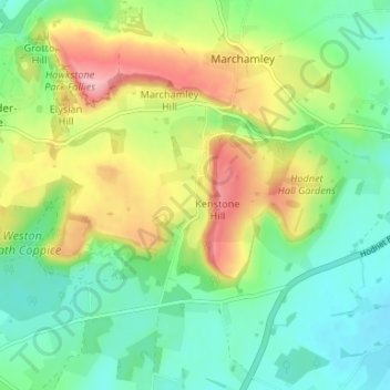
Name: Kenstone topographic map, elevation, terrain.

Location: Kenstone, Hodnet, Shropshire, England, TF9 3LH, United Kingdom (52.82751 -2.62948 52.86751 -2.58948)

Average elevation: 122 m

Minimum elevation: 72 m

Maximum elevation: 210 m

Gear up for your next adventure:

🛏️Sleeping Bag - Warm and compact sleeping bags for outdoor camping
🥾Trail Hiking Boots - Supportive boots for rough trails
🥾Hiking Gaiters - Protect legs and shoes from mud, snow, and debris
❄️Traction Ice Cleats - Slip-on spikes for icy trails and winter hiking
💡LED Headlamp - Hands-free illumination for night hiking and camping

As an Amazon Associate, this site earns from qualifying purchases at no extra cost to you.