
Camden topographic map
Click on the map to display elevation.
Camden
According to the U.S. Census Bureau, the town has a total area of 26.65 square miles (69.02 km2), of which 18.24 square miles (47.24 km2) is land and 8.41 square miles (21.78 km2) is water. Drained by the Megunticook River, Camden is located beside Penobscot Bay and the Gulf of Maine, part of the Atlantic Ocean. Principal bodies of water include: Megunticook Lake, Hosmer Pond (54 acres), Impoundment (Seabright Pond) (74 acres) and Lily Pond (32 acres). Mount Megunticook has an elevation of 1385 feet (419 m).
About this map
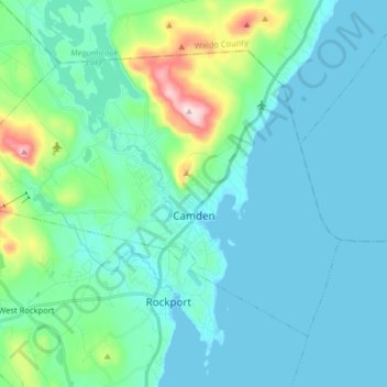
Name: Camden topographic map, elevation, terrain.
Location: Camden, Knox County, Maine, 04843, United States (44.17420 -69.16544 44.25946 -69.00469)
Average elevation: 63 m
Minimum elevation: -2 m
Maximum elevation: 410 m
Other topographic maps
Click on a map to view its topography, its elevation and its terrain.