Geolocate

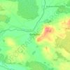
Shean topographic map

Click on the map to display elevation.

About this map

Name: Shean topographic map, elevation, terrain.

Location: Shean, Edenderry Rural ED, The Municipal District of Edenderry, County Offaly, Leinster, Ireland (53.29385 -7.08433 53.31399 -7.04593)

Average elevation: 71 m

Minimum elevation: 64 m

Maximum elevation: 83 m

Other topographic maps

Click on a map to view its topography, its elevation and its terrain.

Cappincur

Ireland > County Offaly

Average elevation: 65 m

Banagher

Ireland > County Offaly > Banagher

Average elevation: 43 m

Charlestown

Ireland > County Offaly > Charlestown

Average elevation: 61 m

Rahan

Ireland > County Offaly

Average elevation: 53 m

Ballycommon

Ireland > County Offaly

Average elevation: 80 m

Rath

Ireland > County Offaly

Average elevation: 66 m

Daingean

Ireland > County Offaly

Average elevation: 82 m

Durrow

Ireland > County Offaly

Average elevation: 66 m

Mount Lucas

Ireland > County Offaly

Average elevation: 76 m

Croghan

Ireland > County Offaly

Average elevation: 100 m

Rathvilla

Ireland > County Offaly

Average elevation: 72 m

Coolderry

Ireland > County Offaly

Average elevation: 107 m

Harbour

Ireland > County Offaly

Average elevation: 62 m

Rahan

Ireland > County Offaly

Average elevation: 53 m

Gear up for your next adventure:

🧣Evaporative Cooling Towel - Beat the heat during intense summer climbs
🪑Ultralight Camping Stool - Compact seating for rest stops during long hikes
🪜Heavy Duty Carabiners - Multi-use clips for securing gear to your backpack
🥾Trail Hiking Shoes - Durable shoes designed for rugged trails
🗺️Topographic Maps - Detailed maps to explore trails, mountains, and wilderness areas

As an Amazon Associate, this site earns from qualifying purchases at no extra cost to you.