Geolocate

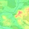
Banagher topographic maps

Click on a map to view its topography, its elevation and its terrain.

Banagher

Ireland > County Offaly > Banagher

Average elevation: 43 m

Gear up for your next adventure:

🗺️Topographic Maps - Detailed maps to explore trails, mountains, and wilderness areas
🚑Survival Whistle - Signal for help across long distances in mountains
💧Hydration Pack - Hands-free hydration system for long hikes
🎒Fully Waterproof Backpack - Total protection for photography gear and electronics
🔥Emergency Fire Starter - Reliable ignition source for all weather conditions

As an Amazon Associate, this site earns from qualifying purchases at no extra cost to you.