Geolocate

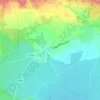
34210 topographic map

Click on the map to display elevation.

About this map

Name: 34210 topographic map, elevation, terrain.

Location: 34210, Cesseras, Béziers, Hérault, Occitanie, France métropolitaine, France (43.25474 2.53955 43.45846 2.87577)

Average elevation: 327 m

Minimum elevation: 21 m

Maximum elevation: 1,005 m

Other topographic maps

Click on a map to view its topography, its elevation and its terrain.
Fauzan

France > Occitanie > Hérault > Cesseras

Average elevation: 267 m

La Cayla

France > Occitanie > Hérault > Cesseras

Average elevation: 83 m

Balme Rouge

France > Occitanie > Hérault > Cesseras > Fauzan

Average elevation: 308 m

Montcélèbre

France > Occitanie > Hérault > Cesseras

Average elevation: 218 m

Gear up for your next adventure:

🔋Solar Power Bank - Keep your GPS and devices charged during long outdoor trips
💡LED Headlamp - Hands-free illumination for night hiking and camping
🧤Thermal Hiking Gloves - Grip-enhanced gloves for cold-weather altitude trekking
☕Camping Coffee Maker - Brew fresh coffee anywhere on the topographic map
🧣Merino Neck Gaiter - Protects against wind, sun, and cold at high altitudes

As an Amazon Associate, this site earns from qualifying purchases at no extra cost to you.